
This week brought a mix of extreme weather across the region, including high winds, soaring temperatures and sudden thunderstorms.
This trend is expected to continue over the weekend with more above average temperatures, gusty conditions, and a chance of thunderstorms before calming down next week.
Currently, it’s 21 C at the Villeneuve weather station, with a gentle southwest breeze at 13 km/h. Temperatures are expected to fall to 14 C this evening as southeast winds strengthen to 20 km/h, gusting up to 40 km/h. Environment Canada has issued a special air quality statement due to wildfire smoke in the region, resulting in poor air quality.
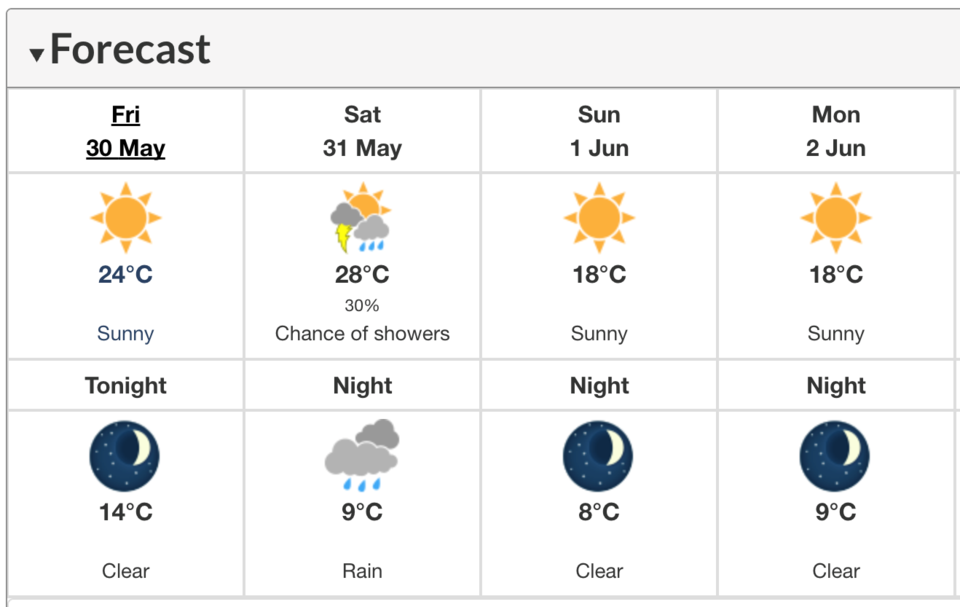
Saturday, May 31, is expected to bring the heat, with the weekend’s high reaching 28 C. But the clear skies won’t last. Clouds will roll in by the afternoon, along with a 30 per cent chance of showers and a risk of a thunderstorm. As the weather shifts, the wind will pick up speed, gusting to 50 km/h by evening. Rain is expected overnight, with temperatures dropping to a low of 9 C.
By Sunday, June 1, the rainy weather is expected to clear out, making way for a fresh start to the month. Sunshine returns, but cooler temperatures settle in, with a high of 18 C. The evening stays clear and calm, with overnight lows dipping to 8 C.
Similar temperatures to Sunday are expected throughout the rest of the week.


