
The Alberta government’s new online map of historic place names needs more detail and some corrections before it can become a reliable source for students, says a St. Albert historian.
Alberta Arts, Culture, and Status of Women Minister Tanya Fir launched the Alberta Geographical Names Web Map on Jan. 3, 2025. The online map offers brief explanations of the history behind place names throughout Alberta, and is pitched as a reference tool for teachers, students and history enthusiasts.
“History is everywhere, and I hope the Alberta Geographical Names Web Map sparks curiosity in all of us to get online and learn more about the places around us,” Fir said in a statement.
In an email, press secretary Garrett Koehler said the map’s information was based on the work of the Alberta Geographical Names Program, which has been documenting the origins of Alberta place names since 1974.
Needs improvement?
The map lists the names of a considerable number of locations across Alberta, with an emphasis on lakes, rivers, railway crossings, and post offices. Sturgeon County locations on it include Alexander First Nation (named after Chief Alexandre Katstaweskum), Manawan Lake (the Cree equivalent of “egg-gathering place”) and New Lunnon (a former post office named after a mispronunciation of “London”).
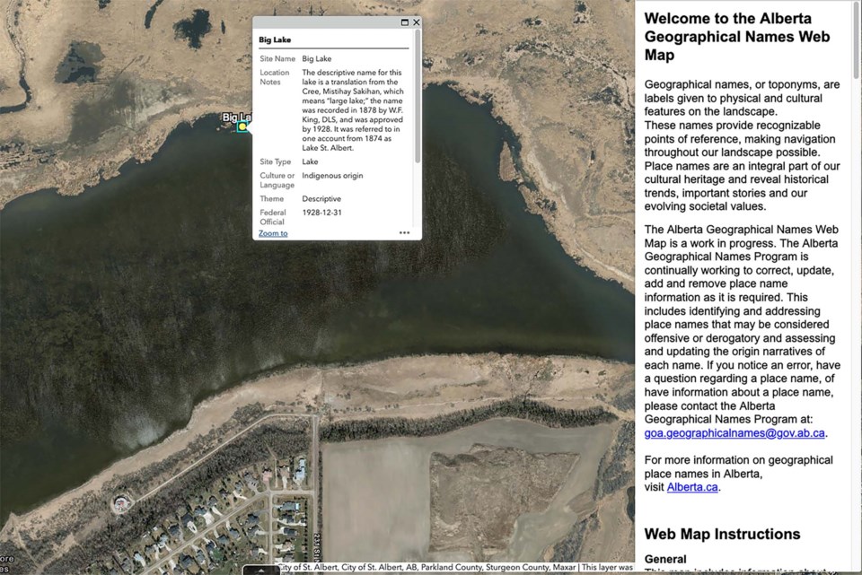
The map includes a handful of locations linked to St. Albert, including Big Lake, the Sturgeon River, and the city itself. It states Lois Hole Centennial Provincial Park was named after former lieutenant-governor Lois Hole, and that Big Lake was a translation of its original Cree name of Mistihay Sakihan (“large lake”).
Musée Héritage Museum archivist Vino Vipulanantharajah criticized the map for not listing the sources for its information, saying such citations are essential if it is to be used by researchers. He also questioned how its makers chose which place names to highlight. It has two references related to Campbell Park, for example, but none for the scores of other streets and places listed in A History of Street Names in St. Albert.
“If this is just it, then this is quite lacking,” he said.
Some entries on the map are incomplete or incorrect. Its description for St. Albert says Bishop Taché and Father Lacombe chose to create a Catholic mission here while “travelling from Fort Edmonton to Lac Ste. Anne,” for example — they were actually headed the other way, from Lac Ste. Anne to Edmonton, Vipulanantharajah noted.
Anyone who wants to correct or update the map should email the Alberta Geographical Names Program at [email protected]. The map itself can be found at geospatial.alberta.ca/go/placenames.


