
Want to know what the property taxes are for that nice house across the street?
A new interactive map on the city’s website allows residents to research just that and a whole lot more city data, such as property values and aerial photographs.
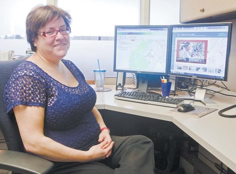
Most of the information could already be found on the city’s website but a newly-implemented application called Landscape offers more detail, said Tammy Kobliuk, St. Albert's geographic information services co-ordinator.
“It has a lot more information on it than the old map. And we did not have a good interactive map previously available to the public,” she said.
“They can go on there and they can see our aerial photos now. They can make their own maps, they can print maps and they can draw on the maps.”
Kobliuk said Landscape offers users a number of tools to write text, add points, shade areas or measure distances on the map. They can later save the file as a PDF, and e-mail or print them.
Users can also look up the value of a home, its tax levies, the year it was built, parcel lines and its legal description. If they want to take a closer look, the program offers a zoom-in function and also links to Google Street View.
“The difference to Google is that this (map) is a lot more precise,” said Kobliuk.
“Ours has the parcel lines and ours has the address numbers. And our addresses are precise whereas with Google they are estimated.”
Mayor Nolan Crouse said applications such as Landscape are just another step to making information more accessible to the public.
People are increasingly using the city’s website instead of looking for brochures, he said, so it is important to give them the information they are looking for.
“This whole notion of open data and going online to be able to find things and learn things and manipulate things is absolutely fundamental for the future of municipalities,” he said.
Completion of Landscape took about 15 months. Another new mapping application, the public art tour program, should be ready soon, said Kobliuk.
The tour will offer high-resolution photos and information on all 30 of the city’s outdoor, permanent art installations.
To use Landscape visit Property Assessment and Tax Information on www.stalbert.ca/online-services.


