
It has been a rip-roaring summer for people living in St. Albert.
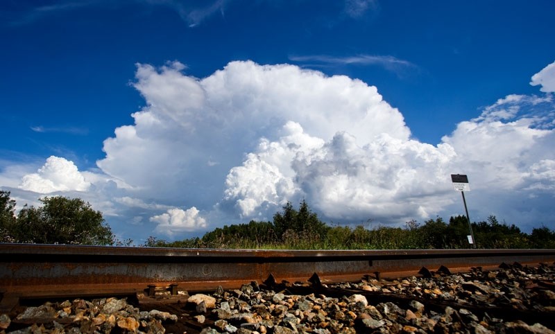
The skies above the city have been alive all summer with more severe weather than usual.
In July the region saw 16 separate days where a thunderstorm occurred compared to the usual 10 days. Typically the storms would last for just an hour, but several of the storms charged on for six hours. Overall for July, more than half the days were spent running from the rain or hiding indoors waiting out a storm.
Similarly, June also had a lot more loud days than usual with 12 thunderstorms lighting up the sky compared to the seasonal average of seven storms during the month.
Despite the stormy summer, the Edmonton and surrounding region do not see as many storms as other cities do across Canada. The region ranks 23rd out of 25 cities for frequency of lightning storms of all major regions across Canada.
Along with the wild storms, the summer has been hotter and wetter than usual.
May began with a blitz of warm weather, skyrocketing temperatures and removing any remnants of the white winter.
“You almost went from slush to sweat,” David Phillips, senior climatologist at Environment Canada said. “May was particularly wet with twice as much rain falling than usual.”
The wet trend has continued throughout the summer with the region seeing 20 per cent more precipitation than usual falling from the many summer storms that have shaken the city so far.
“Precipitation has been up, there is no question about that,” Phillips said.
Phillips said that overall there have been fewer rainy days, but on the days that the sky does open up, more rain will fall. This trend has been contributing to the flooded highways and sudden lakes that appear during every summer storm.
The climate in the region has been a little extra toasty, too. Since May, the area has had 30 days see the temperature rise above 25 degrees Celsius compared to the seasonal average of 17.
“There have been a lot of days that have been beer-drinking kind of weather,” Phillips said. “ May, June and July have behaved in the same way, with all of the months being warmer than normal but nothing record breaking, which is good news.”
Typically temperatures for the summer peak during the last day of July and the first day of August, and then slowly subside after that. This year the forecast for the August long weekend is cooler than normal and rain is expected for each day.
“There is still a lot of summer left,” Phillips said. “There will still be many warm days in August. If you left your holidays to the end there is still a lot of time left to enjoy the summer.”
August and September should usher in more normal weather patterns and temperatures for the region but the stormy weather isn’t quite done yet.
“We aren’t going to see the end of the severe weather,” Phillips said. “The peak of it comes in July, but August can see some active weather too.”
The long weekend calls for rain during all three days, but the best weather is expected on Saturday with a 50 per cent chance of precipitation and a high of 23 degrees Celsius.


